Adams County Iowa
Farmland Value Profile

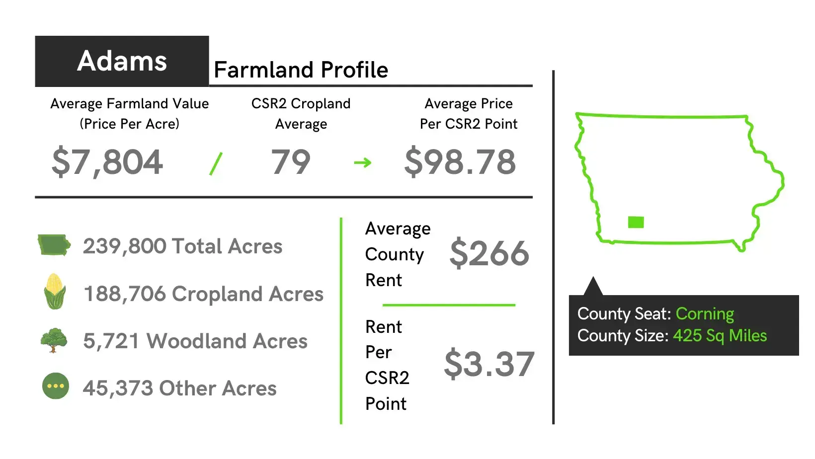
- The average value of farmland in Adams County is $7,804 per acre which is up $424 from 2022 to 2023.
- The average price of tillable farmland per CSR2 point in Adams County is $98.78 for 2023 land auctions.
- Adams County is ranked #91 in the state of Iowa in average dollars per acre for tillable farmland.
- The highest sale of farmland in Adams County in 2023 was $15,500 per acre.
| Location | Southwest Iowa |
|---|---|
| County Size | 425 sq. miles |
| Total Acres | 239,800 |
| Cropland Acres | 188,706 |
| Average Price Per Acre Farmland | $7,804 |
| Average Price Per Acre for Southwest, IA | $9,505 |
| CSR2 Weighted Average | 61.1 |
| CSR2 Cropland Average | 79 |
| State Average CSR2 | 68.6 |
| Average Price per CSR2 | $98.78 |
| Average County Rent | $266 |
| Rent Range | $194 - $257 |
| Average rent for South West Iowa | $265 |
| Rent per CSR2 Point | $2.84 |
| Improved Permanent Pasture | $101 |
| Unimproved Permanent Pasture | $66 |
| Stalk Grazing per Acre | $9 |
| Hunting Rights per Acre | $11 |
Towns: Carbon, Prescott, Coing, Nodaway
Unincorporated Areas: Brooks
Townships: Carl, Jasper, Prescott, Colony, Lincoln, Quincy, Douglas, Mercer, Union, Grant, Nodaway, Washington
History: Adams County was established by the state legislature in 1851 and named in honor of the second President of the United States, John Adams, or his son, the sixth President, John Quincy Adams (sources differ). The county was finally organized and separated from Pottawattamie County on March 12, 1853. Its original size was later reduced by the creation of Montgomery and Union Counties. The first county seat was Quincy. In 1872, it was moved to Coing.
Adams County Iowa Farmland Sales Resources
- Adams County Iowa Website
- Adams County Assessor GIS Website
- Land Prices on our Iowa Farmland Prices Heatmap
- Free E-Book on How to Sell Land
- Find an Iowa Estate Attorney
Selling Land with DreamDirt
When it comes to marketing and selling your land, having the right team and the right tactics is of invaluable importance. As professionals in the rural real estate and auction industry, our team has assisted family heirs and farmers in over 9,000 transactions and counting! Not sure where to start? Learn more about our land sales process, explore frequently asked questions, or simply let our team know you’d like to talk.
DreamDirt Marketing Highlights

