Appanoose County Iowa Farmland Value Profile

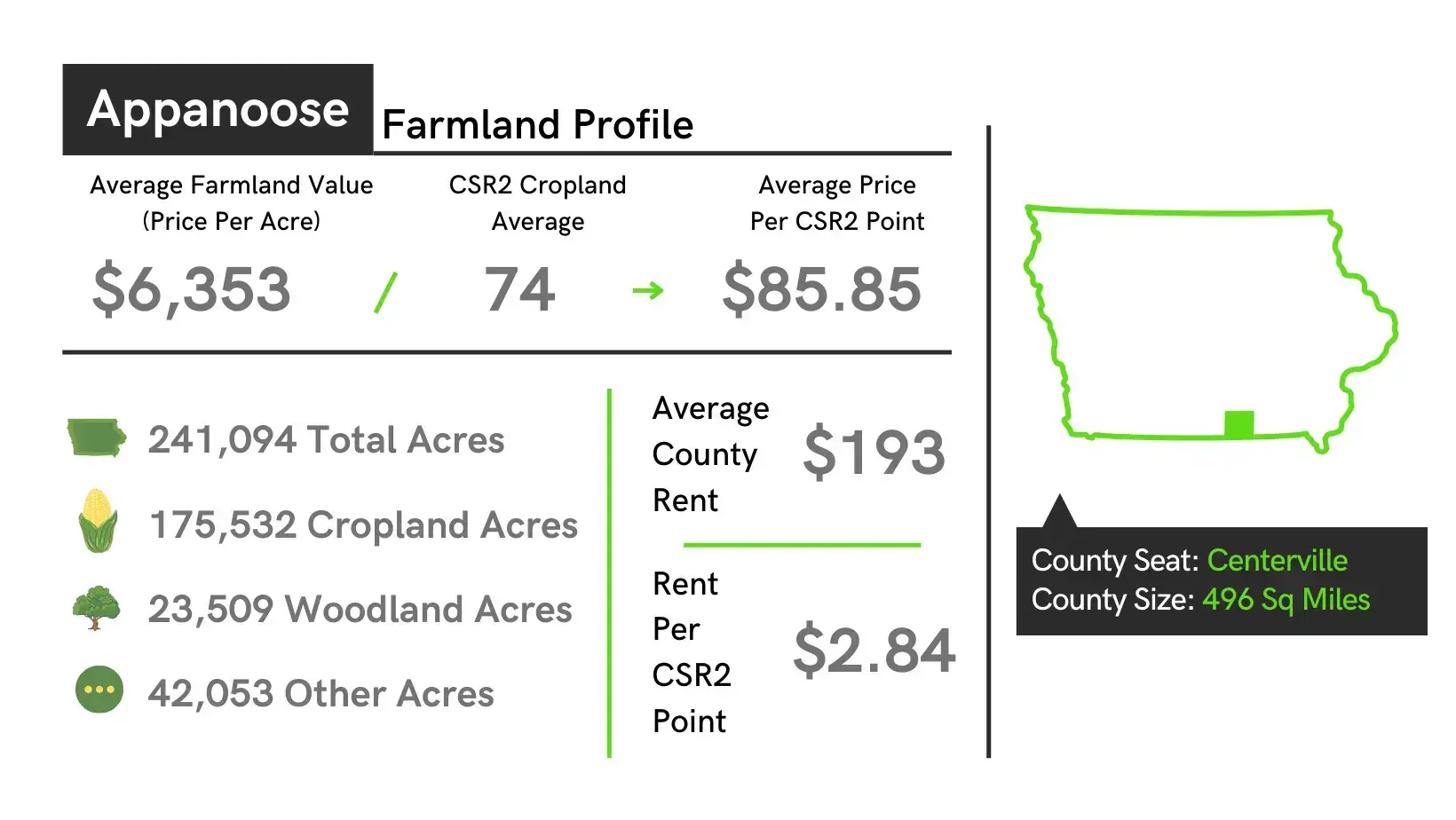
- The average value of farmland in Appanoose County is $6,353 per acre which is up $727 from 2022 to 2023.
- The average price of tillable farmland per CSR2 point in Appanoose County is $85.85 for 2023 land auctions.
- Appanoose County is ranked 98 in the state of Iowa in average dollars per acre for tillable farmland.
- The highest sale of farmland in Appanoose County in 2023 was $8,900 per acre.
| Location | South Central Iowa |
|---|---|
| County Size | 496 sq. miles |
| Total Acres | 241,094 |
| Cropland Acres | 175,532 |
| Average Price Per Acre Farmland | $6,363 |
| Average Price Per Acre for South Central, IA | $7,482 |
| CSR2 Weighted Average | 44 |
| CSR2 Cropland Average | 74 |
| State Average CSR2 | 68.6 |
| Average Price per CSR2 | $85.85 |
| Average County Rent | 193 |
| Rent Range | $158 - $232 |
| Average rent for South Central Iowa | $227 |
| Rent per CSR2 Point | $2.84 |
| Improved Permanent Pasture | $87 |
| Unimproved Permanent Pasture | $58 |
| Stalk Grazing per Acre | $15 |
| Hunting Rights per Acre | $11 |
Towns: Centerville, Moravia, Numa, Udell, Cincinnati, Moulton, Plano, Unionville, Exline, Mystic, Rathbun
Townships: Bellair, Independence, Taylor, Washington, Caldwell, Johns, Udell, Wells, Chariton, Lincoln, Union, Douglas, Pleasant, Vermillion, Franklin, Sharon, Walnut
History: Appanoose County was formed on February 17, 1843, from open territory. It was named for the Meskwaki Chief Appanoose, who did not engage in war against Black Hawk, advocating peace. The present county seat was formerly called Chaldea, and was later renamed to Senterville in honor of Goveor Senter of Tennessee. In April 1848, the courthouse, constructed at the expense of $160, was put into use and served as such until 1857. The second courthouse was opened in 1864, and was bued down to the first floor during an explosive Fourth of July fireworks demonstration. The third courthouse was dedicated on May 21, 1903, and remains in use. Appanoose County was once a coal mining area with the Centerville Block Coal mine raning in the top 24 producers of coal in the state.
Appanoose County Iowa Farmland Sales Resources
- Appanoose County Iowa Website
- Appanoose County Assessor GIS Website
- Land Prices on our Iowa Farmland Prices Heatmap
- Free E-Book on How to Sell Land
- Find an Iowa Estate Attorney
Selling Land with DreamDirt
When it comes to marketing and selling your land, having the right team and the right tactics is of invaluable importance. As professionals in the rural real estate and auction industry, our team has assisted family heirs and farmers in over 9,000 transactions and counting! Not sure where to start? Learn more about our land sales process, explore frequently asked questions, or simply let our team know you’d like to talk.
DreamDirt Marketing Highlights

