Lee County Iowa Farmland Value Profile

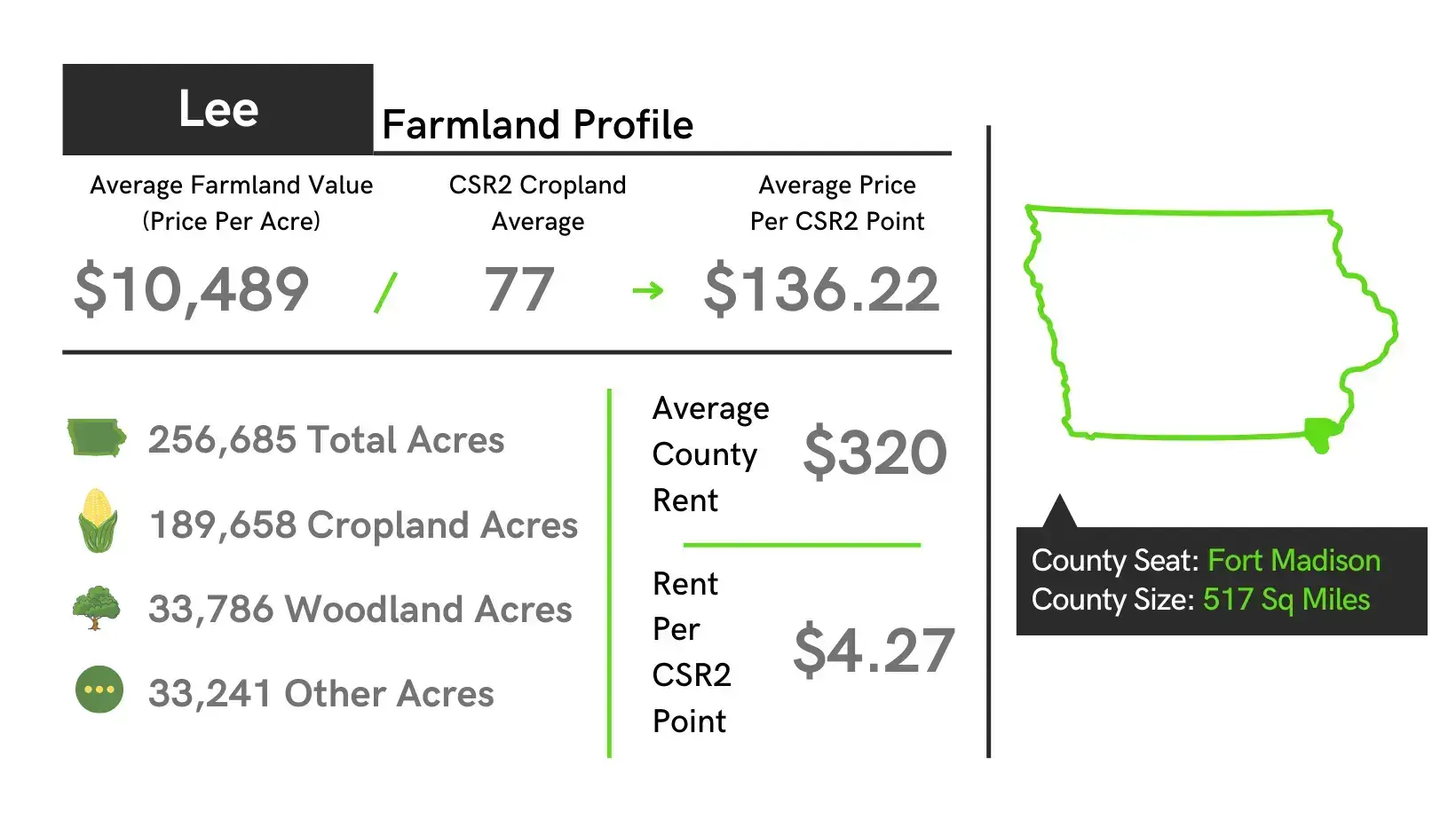
- The average value of farmland in Lee County is $10,489 per acre which is up $1,098 from 2022 to 2023.
- The average price of tillable farmland per CSR2 point in Lee County is $136.22 for 2023 land auctions.
- Lee County is ranked 76 in the state of Iowa in average dollars per acre for tillable farmland.
- The highest sale of farmland in Lee County in 2023 was $17,561 per acre.
| Location | Southeast Iowa |
|---|---|
| County Size | 517 sq. miles |
| Total Acres | 256,685 |
| Cropland Acres | 189,658 |
| Average Price Per Acre Farmland | $10,489 |
| Average Price Per Acre for Southeast, IA | $10,460 |
| CSR2 Weighted Average | 52.3 |
| CSR2 Cropland Average | 77 |
| State Average CSR2 | 68.6 |
| Average Price per CSR2 | $136.22 |
| Average County Rent | $320 |
| Rent Range | $257-$383 |
| Average rent for Southeast, Iowa | $252 |
| Rent per CSR2 Point | $4.27 |
| Improved Permanent Pasture | $79 |
| Unimproved Permanent Pasture | $56 |
| Stalk Grazing per Acre | $13 |
| Hunting Rights per Acre | $16 |
If you have questions about selling farmland see our Iowa Farmland Sales FAQ or get a Free Farmland Market Analysis.
Towns: Donnellson, Keokuk, Ford Madison, Montrose, Franklin, West Point, Houghton, St. Paul
Unincorporated Areas: Pilot Grove, Wever, Denmark, Argyle, New Boston
Townships: Cedar, Marion, Pleasant Ridge, Denmark, Green Bay, Washington, West Point, Franklin, Harrison, Van Buren, Charleston, Jefferson, Madison, Montrose, Des Moines, Jackson
History: Fort Madison dates to the war of 1812. Lee County was the location of the “Half-Breed Tract”, established by treaty in 1824. Allocations of land were made to American Indian descendants of European fathers and Indian mothers at this tract. Originally the land was to be held in common. Some who had an allocation lived in cities where they hoped to make better livings. Large-scale European-American settlement in the area began in 1839, after Congress allowed owners to sell land individually. Members of the Church of Christ (Latter Day Saints) fled persecutions in Missouri to settle in Illinois and Iowa. Although Nauvoo, across the border in Hancock County, Illinois, became the main center of Latter-day Saints settlement, there was also a stake organized in Lee County under the direction of John Smith, the uncle of Joseph Smith.
Lee County Iowa Farmland Sales Resources
- Lee County Iowa Website
- Lee County Assessor GIS Website
- Land Prices on our Iowa Farmland Prices Heatmap
- Free E-Book on How to Sell Land
- Find an Iowa Estate Attorney
Selling Land with DreamDirt
When it comes to marketing and selling your land, having the right team and the right tactics is of invaluable importance. As professionals in the rural real estate and auction industry, our team has assisted family heirs and farmers in over 9,000 transactions and counting! Not sure where to start? Learn more about our land sales process, explore frequently asked questions, or simply let our team know you’d like to talk.

